
Drone Surveys
Survey Your Sites Up To 5x Faster

Our drone survey team are fully qualified and compliant pilots with the Civil Aviation Authority (CAA) - General Visual Line of Sight (GVC) and European Union Aviation Safety Agency (EASA)- Open A2 regulations for Remotely Piloted Aircraft Systems.
Our drone survey services offer award-winning accuracy, efficiency, and cost-effectiveness. From construction sites and infrastructure inspections to environmental monitoring and land surveying, we provide the data you need to make informed decisions.
Benefits of our drone surveys include:
Effective and efficient data collection - reducing time spent on site
Reduced site/risk exposure leading to increased safety
Repeatable surveys - excellent for project monitoring
Virtual models showcasing your project without having to step foot on the ground
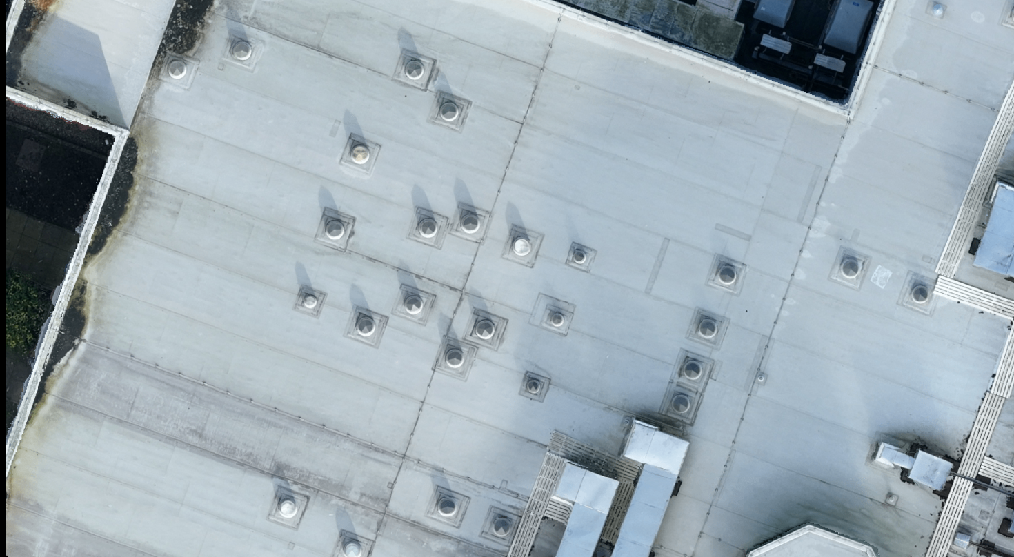
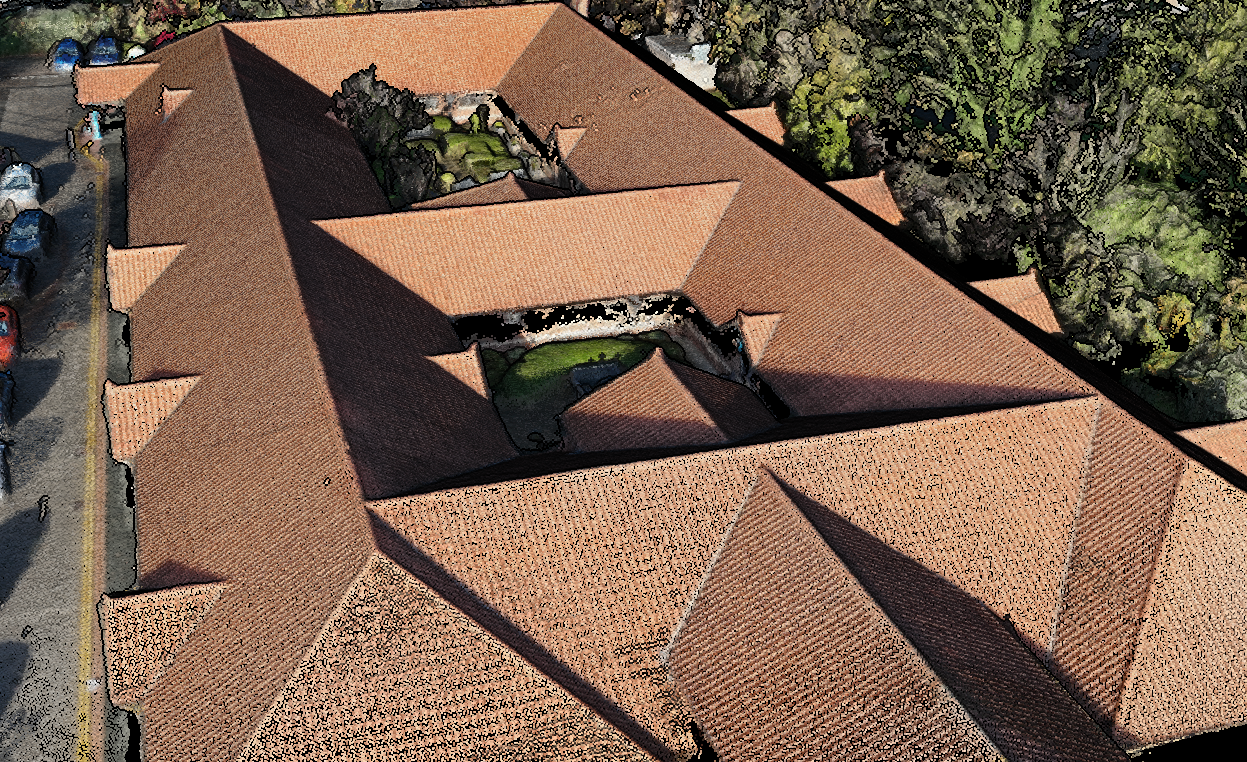
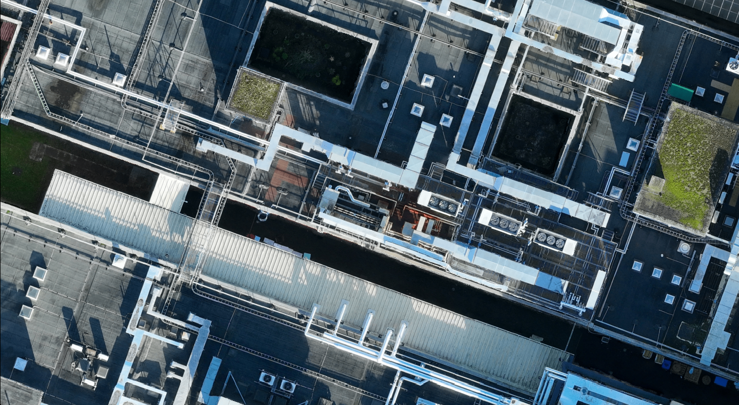
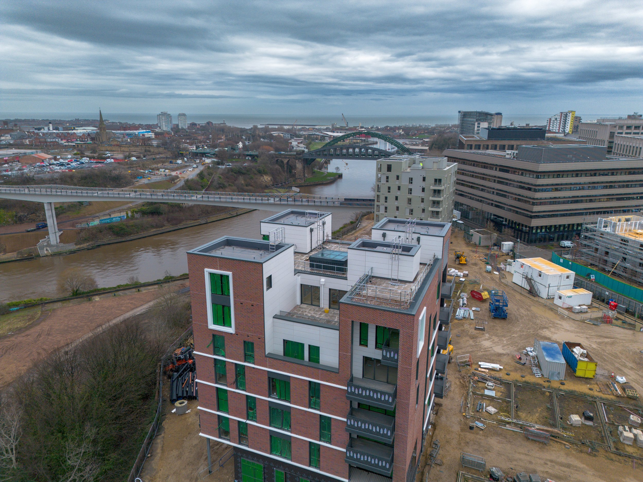
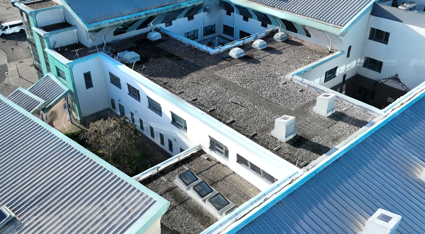
Access hard-to-reach areas - ideal for telephone mast inspections, high rise buildings, and more
Accurate and precise geospatial datasets
At LAT, we offer a variety of photogrammetry, LiDAR, inspection, and videography/photography services.
Our drones are equipped with high-resolution cameras and sensors, allowing them to capture detailed images, videos, and data about landscapes, structures or other features of interest including:
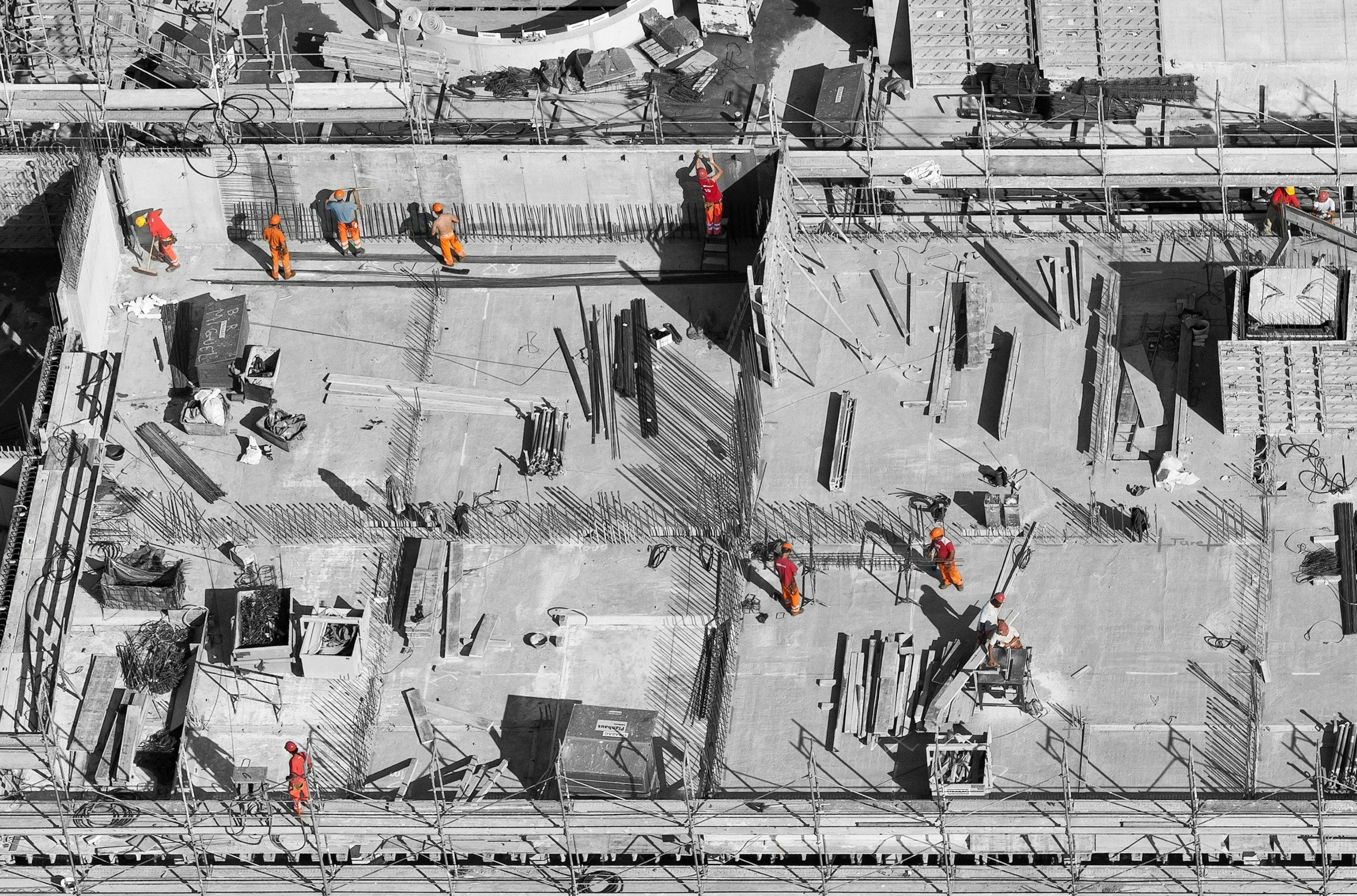
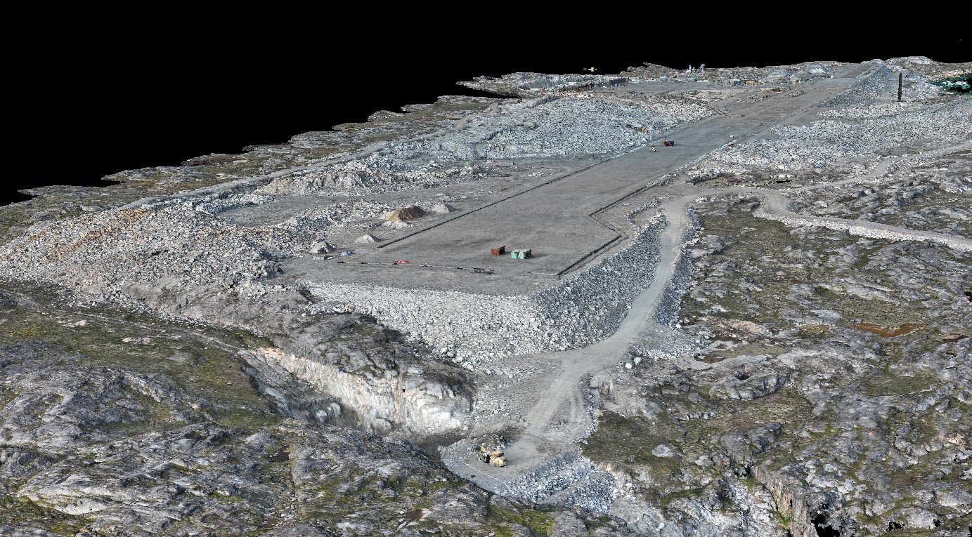
Monitoring construction progress
Assessing site conditions
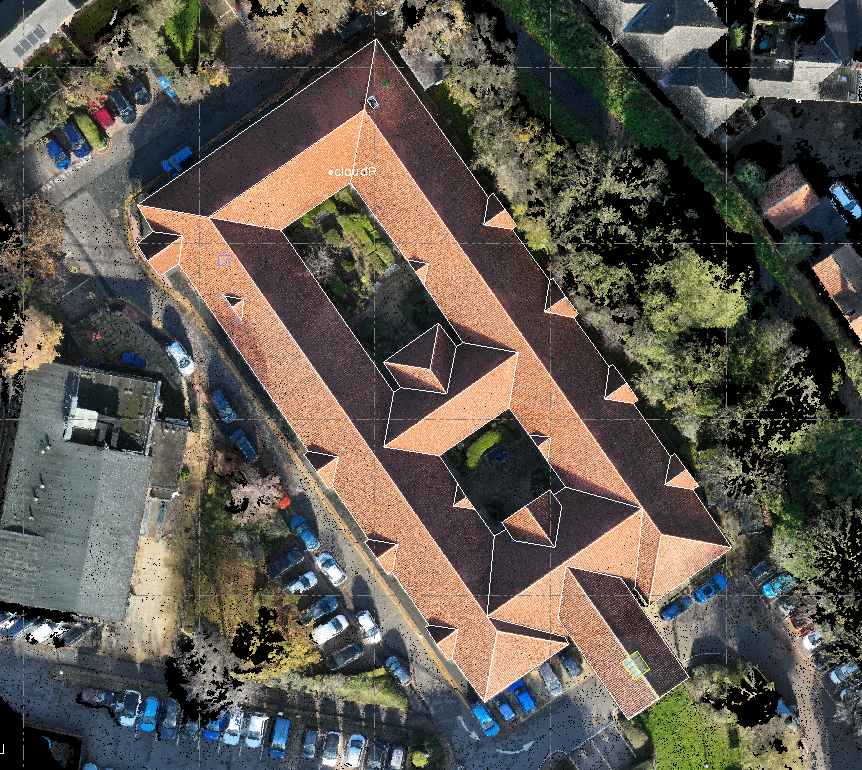
Creating 3D models for design and planning
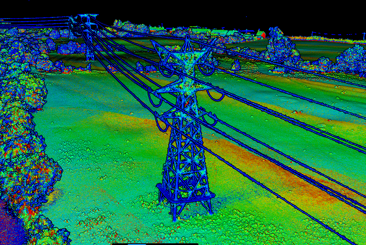
Inspecting bridges, pipelines, power lines and other infrastructure for maintenance and safety purposes
Assessing damage after natural disasters such as floods and storms
After our drone surveys, the data are processed using specialised software to create maps or other products that can be used for analysis or presentation purposes.
Deliverables such as:
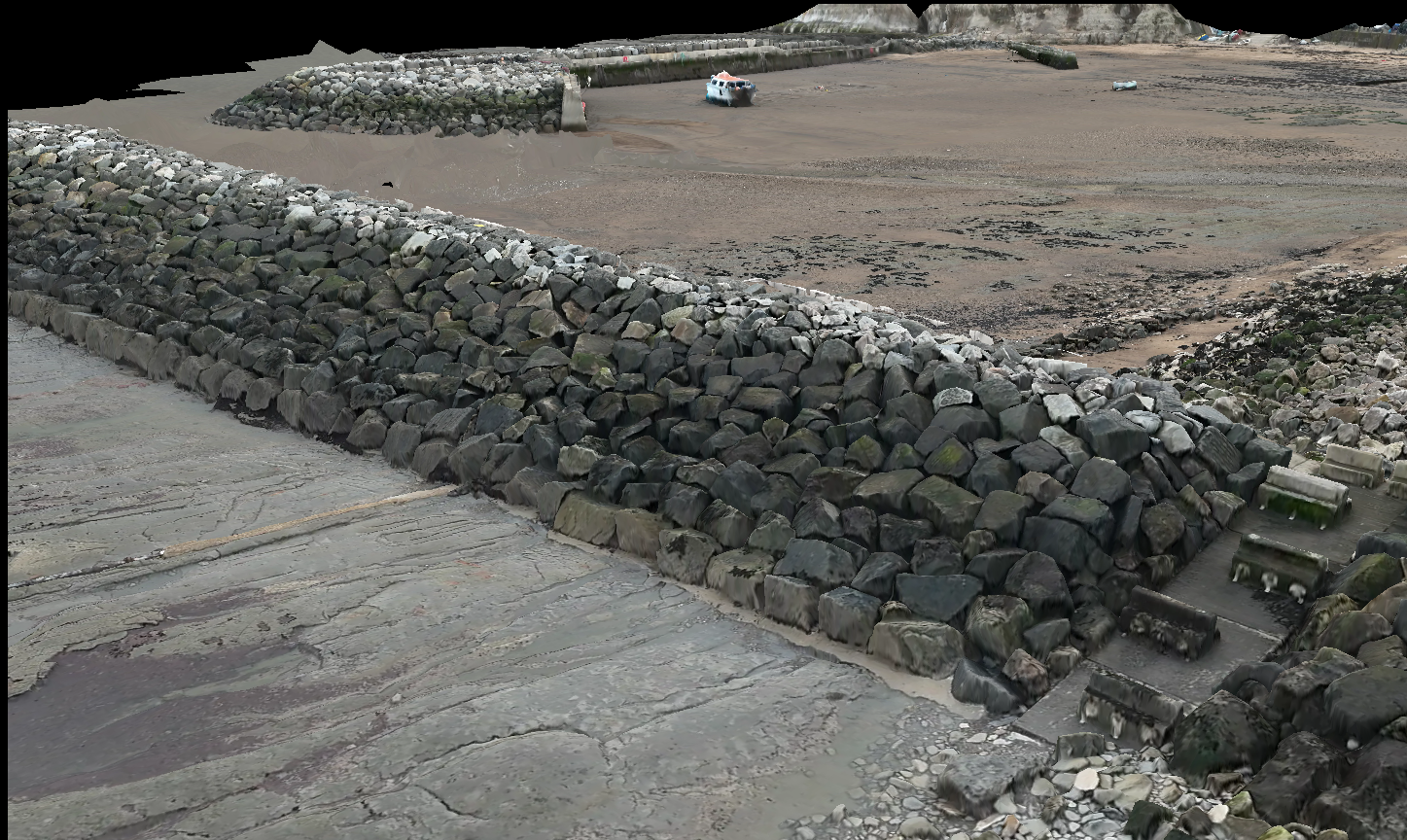
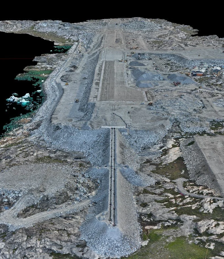
Point clouds
Orthomosaic imagery
Digital Surface Model/Terrain (DSM/DTM)
3D Built Environments/Flythroughs
Volumetric/Stockpile Calculations
High resolution images and videos
And more!
All of our drone survey deliverables are interoperable with CAD and GIS software packages.
As well as being more efficient and safer than other methods, drone surveys can be used alongside more traditional methods to create a more detailed plan of the site.
With hundreds of flying hours, we guarantee quality. Get in touch for more information on how we can support your business.


Commissioning a Drone Survey?
Complete the form to get your FREE client checklist.


Drone Data Processing
Do you already collect drone data in-house? We can process your raw data into professional 3D and 2D models.
No project is too big or too small, and we can provide expert guidance on how to best optimise your drone surveying workflows.
Get in touch with our award-winning team for more information.
Trusted partners:


Testimonials
Request A Drone Survey
-
UK CAA regulations stipulate that drones can fly at a maximum altitude of 400ft (120m) above ground level. They must also be operated within Visual Line of Sight (VLOS) at all times, up to a maximum distance of 500m from the remote pilot.
-
Accuracy depends on the technology used. Modern enterprise drones typically achieve 2-5cm when coupled with ground control points (GCPs) and check points (CPs).
-
Legally you do not need your neighbour’s permission to fly over their property, provided that drone is flown within the laws and regulations laid down by the CAA. You must comply with GDPR and Privacy Laws, however. It is best-practice to inform all land-owners of your intended flight mission.
-
This is dependent on the type of survey you have commissioned. High resolution images and videos are common for roof inspections whilst orthomosaics, point clouds, and digital elevation models (DEM) are common for topographic surveys.
-
For topographic surveying, a 4 hectare site can be surveyed in under 30 minutes. However, the “work” is in the processing. 3D models and CAD/GIS deliverables can take up to 3-5 days to generate.